MAPPING SERVICES
Information on FRWA Mapping Services
Why Does My System Need to be Mapped?
Today, more than ever, it’s important to keep up to date maps of our Water and Wastewater Systems. Many Water and Wastewater Operators are retiring and with them goes the knowledge of your systems layout and important asset locations. Systems are also expanding every day, and now you have information from two different sources to keep up with. FDEP requires systems to have up-to-date utility maps per Rule 62-555.350(14) F.A.C. The maps shall show mains, valves, hydrants, tanks, plants, etc. and a single map or system atlas.
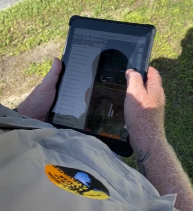
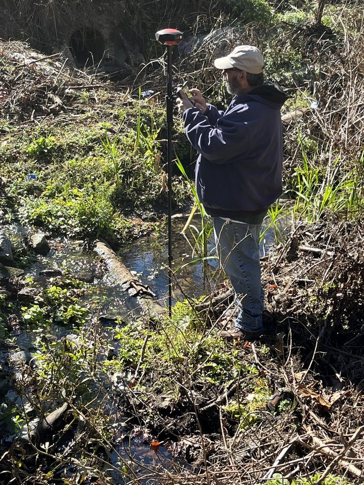
The solution to these problems is collecting Global Positioning System (GPS) data. By collecting your water and wastewater systems data (such as wells, valves, hydrants, water & sewer mains, manholes, lift stations, etc.), it allows you to store and keep data on a computer with the coordinates and attributes of each feature with an accuracy of a meter or less!
FRWA Wants to Help
Having this electronic information allows you to print maps, or create spreadsheets for Asset Management, Valve Exercising Programs, and keep track of your Sample Points or Flushing Locations. It also allows you to view certain areas of your community to diagnose needs and future plans. In emergency situations, you can save valuable time by using the coordinates to go immediately to the needed locations.
Over the past few years, The Florida Rural Water Association (FRWA) has invested a great amount of time and money into GPS equipment and GIS software that would benefit members and their operators in both accuracy and ease-of-use. We know that not every system can afford to purchase their own equipment, so FRWA has purchased several accurate handheld units (accuracy to sub-meter or less) with the software needed to create the necessary maps and/or data files.
Florida Rural Water Association GIS Program
- Members have access to GPS equipment for collecting their own data
- FRWA will train system staff on GPS use
- Download free applicable GIS Data Viewer or provide information on purchasing mapping software
- Members will need to sign a GIS Agreement
- Click here for a Mapping Equipment and GIS Agreement and pricing information
mEMBER BENEFITS
With a minimal fee addressed above, FRWA members will be provided with:
- Training and use of GPS equipment
- Electronic Data/Files (including ESRI shapefile and geodatabase and PDF Wall maps and Map books)
- Accurate Inventory of Assets
- Data Updates (including drawing water and sewer lines when necessary)
- Data Maintenance/Storage
- 1 Printed Wall Map for each system (water and wastewater when applicable)
- 1 Printed 11 x 17 Map Book for each system (water and wastewater when applicable)